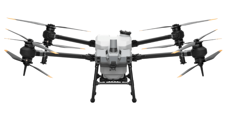
Agricultural Drone Services
NQD provides agricultural drone services covering areas from Cairns, Gordonvale, the Tablelands, Mossman and more…
Our advanced DJI drones are equipped with state-of-the-art technology, enabling farmers to optimise their operations and maximise yields. From crop monitoring and mapping to precision spraying, spreading and crop management, our agriculture drones provide a cost-effective and efficient solution to enhance productivity and reduce manual labour.
Our services allows our clients to:
- Easily identify areas of concern
- Gain detailed insights into field conditions
- Make informed decisions about their crops and/or sites
- Reduce chemical usage and ensure that treatments are accurately applied
- Savings in costs, time and labour
- Increased yield and environmental benefits
Our team of experienced professionals is dedicated to helping Cairns and NQ farmers optimise their operations and achieve sustainable growth. We offer comprehensive training and support to ensure seamless integration of our drone services into existing agricultural practices. With our expertise and commitment to innovation, we aim to revolutionise the way farmers approach precision agriculture.
Agricultural
Services
Spraying
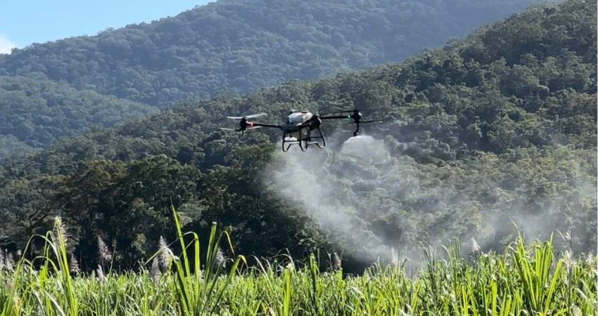
Introducing our exceptional agricultural drone spraying services! With over 1,000 hectares sprayed to date, we have extensive experience in both broadacre and orchard crop applications. We are able to use our precision spray drones to spray crops, diseases, manage weeds, pest control, spot spraying, spraying on waterways and dams, herbicides, pesticides, fungicides and so much more. Our expertise shines in the sugarcane industry, where we have assisted farmers and agronomists in effectively applying Moddus and targeting vine affected paddocks, yielding remarkable results (link to Portfolio).
Equipped with cutting-edge technology, our agriculture drones offer unparalleled precision in orchard crop spraying. Unlike traditional methods, we can precisely target individual trees, ensuring optimal coverage without wasting any product on the rows or gaps between trees.
Our drone spraying system allows for minimal drift, maximum coverage, reduced water usage, unmatched accuracy compared to traditional aircraft systems and most importantly our ability to access areas that your tractor simply cannot reach. Utilising our drone spray services will allow you to target hard to access areas such as boggy, wet, steep or uneven terrain, fence lines, or problem areas affected by soil compaction. At NQD we have the ability to assist you with trying new things on your crops you previously were unable to consider, such as rounding up weeds prior to pumpkin harvest for the health and safety of your picking crews.
Choose our agricultural drone spraying services for unmatched precision, efficiency, and outstanding results. Contact us today to revolutionise your crop spraying practices.
Spreading
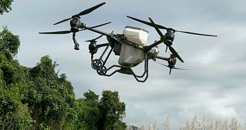
Our DJI T-40 agricultural drones have an interchangeable tank that allows us to turn our spray drone into a spreader too! From spreading seed, feed, granules, fertiliser, and even beneficial insects we are able to fly and spread over your crop or site. Through DJI’s advanced technology we are able to change our flight parameters to suit what is being spread as it can actively weigh and monitor the spread load and remaining load to ensure that the product is dispersed appropriately. This means we can change the application rate and rate that the spreader spreads – with a maximum spreading payload of 50kg.
In the world of beneficial insects, NQD are the one and only aerial beneficial spreaders in the Cairns region. Spreading of beneficial insects is an alternative solution to using pesticide for pest management. We work together with Natural Solutions in Bowen who sources the beneficials and can provide you with the right beneficial insects to sustainably control and manage insect pests in conjunction with agronomic advice. Spreading beneficials via drone is a much faster, safer and more effective way to release them over traditional methods by hand, and also allows for a greater distribution over the crop to target all problem areas and decrease crop disruption. Integrated pest management allows you as a grower to increase your biodiversity and crop yields, as well as to become more financially and environmentally sustainable.
Through the use of beneficials instead of pesticides or insecticides this will also assist with managing pollinators such as bees. One way growers can manage and sustain bees on their farms is to use beneficial insects as opposed to insecticides or pesticides. One of the common reasons large numbers of bee colonies are dying is due to pesticide use in and around crops. Pests can often be controlled by using beneficials which encourages their natural predators and other means of cultural control. By minimising pesticide use it protects our native bee pollinators. Bees are a beneficial insect, so by enhancing the farm environment for these beneficials, it will also increase their abundance over time and can lead to a more consistent crop pollination from year to year.
Check out Natural Solutions beneficial success story that has led to their client having increased yields!
Mapping
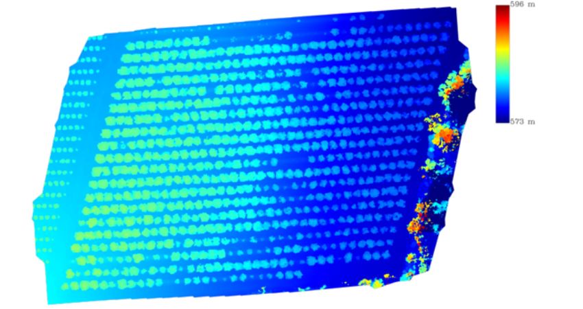
We specialise in providing cutting-edge aerial mapping services using drones to meet all your needs. Our highly trained team conducts aerial crop checks, delivering accurate and early identification of potential issues or diseases. This empowers farmers to take proactive measures, ensuring optimal growth and productivity. Our aerial photographic surveys go beyond expectations, offering detailed imagery like NDVI, Orthomosaics, DSM, elevation, contours, and 2D/3D mapping .This invaluable information enables informed decision-making for irrigation, soil management, and overall farm planning. With our advanced aerial mapping drone technology, we empower farmers and agricultural professionals to optimise their operations and achieve superior results efficiently and sustainably.
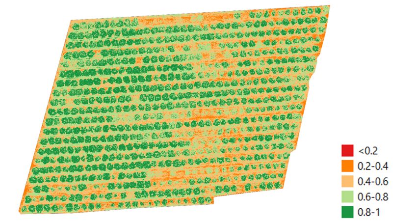
NDVI
NDVI stands for Normalised Difference Vegetation Index and is most commonly used in agriculture to determine the health and Leaf Area Index (LAI) of plants and crops. In simple terms it is a measurement of plant health based on how a plant reflects light at specific frequencies. Through NDVI maps created via the use of drone flyover and other image processing software, farmers, agronomists, and many others can get a better understanding of their crops by looking at patterns and distributions that cannot be seen on foot. NDVI can help Cairns and NQ farmers to properly determine the areas of their crop that are not as healthy as others so that they or their agronomist can check these problem areas on foot to help determine how to improve these areas.
Through NDVI we can calculate the percentage of crop affected by a particular pest or disease such as cane grub, we can check parts of your crop that you can’t see from the outside or reach on foot, we can spot problem areas from above whether that be pig damage, malnutritioned trees, planter misses, and much more. Additionally, NDVI in conjunction with an Orthomosaic can assist you in determining variance in cane varieties, allowing farmers and agronomists to make better informed decisions through a high quality map clearly showing variety changes from above.
We are also able to complete RGB, GNDVI, LCI, NDRE and OSAVI maps if requested.
Don’t miss out on the opportunity to take your agricultural business to new heights. Contact us today to learn more about our drone services and how they can benefit your farm. Together, let’s unlock the full potential of your land and cultivate a prosperous future.
Agricultural
FAQS
